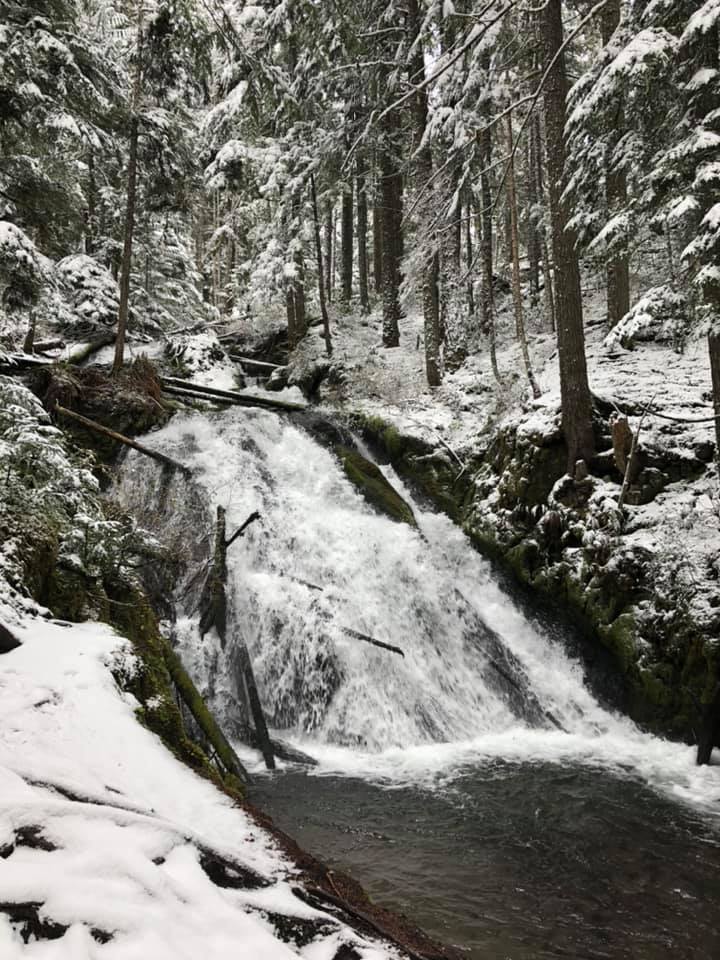
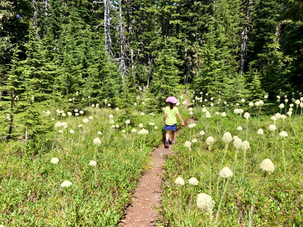
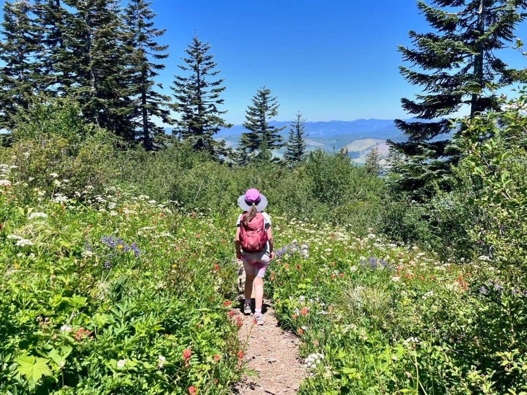
Spring is such a mixed bag around here. In a given year, we can have snow, ice, rain, hail, and sunshine. Spring in the PNW means wildflowers are popping up everywhere, the waterways are full, and temperatures are (should be??) warming up.
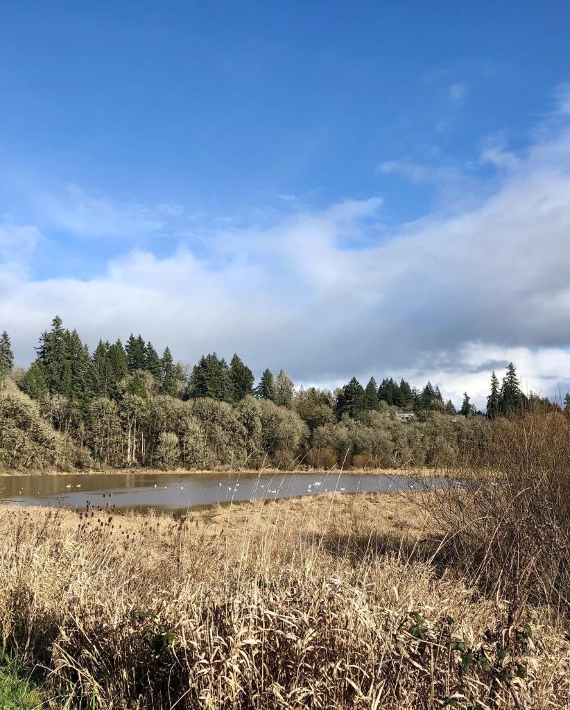
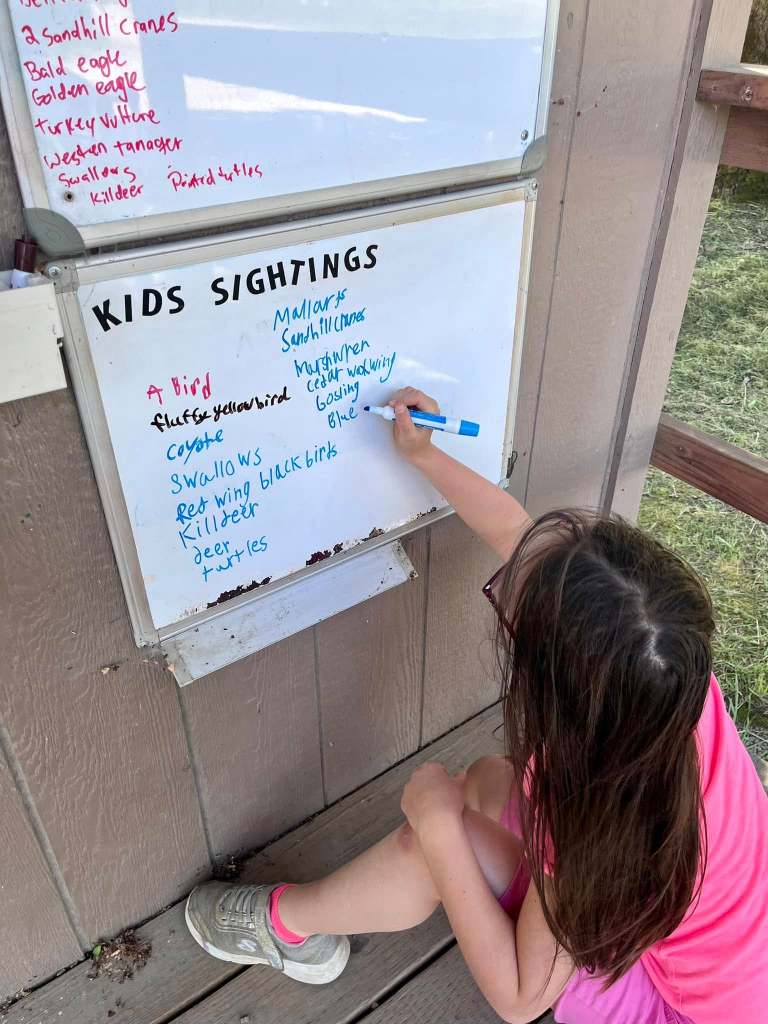
Looking for migratory birds at Ridgefield National Wildlife Refuge
It can be hard to know where to hike in the spring since the weather is constantly changing and snow levels are still quite low. Urban trails, as well as the local national wildlife refuges are usually a good bet with their low elevation and migratory bird excitement. Hikes in the Gorge, as well as most hikes below 2,000 feet are a good bet in spring.
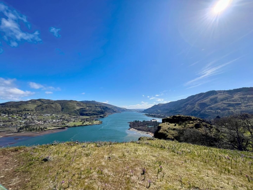
Admiring Latourell Falls in the Columbia River Gorge
While I can’t fully prepare you for spring hiking, below are a few tips on how to hike with your kids in spring:
Plan for quickly changing weather. Check the weather the morning of your hike, but make sure you have extra layers for rain, wind, or hail.
Dress in layers and avoid cotton. The combination of cool spring temperatures and rain can still put you in hypothermia territory.
If you are going up into the area’s national forests, check conditions on trailhead pages (included in book descriptions), as well as here for the Gifford Pinchot National Forest and here for the Mt. Hood National Forest
Assume you will encounter mud and bring a change of clothes for kiddos!
Make sure you do a tick check after your hike and watch out for poison oak, especially when hiking through oak woodlands and east of the Cascades. Learn about how to hike in tick country.
Check out these great spring hiking tips from the Washington Trails Association.
Consider an after-dinner hike as sunset gets later.
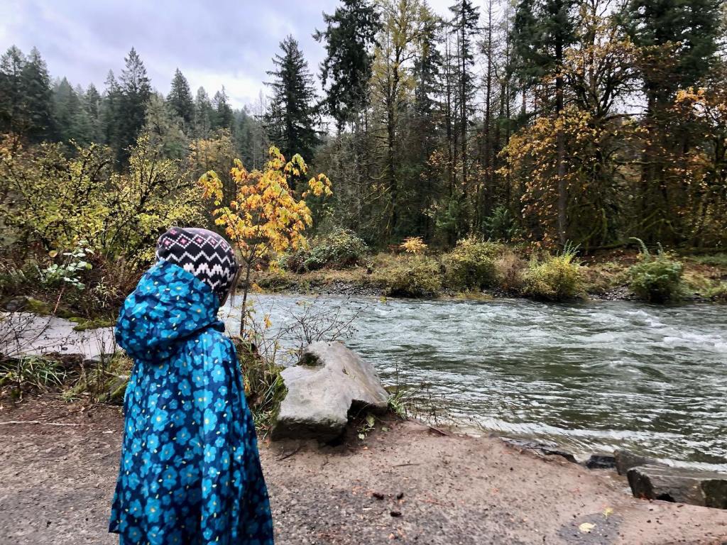
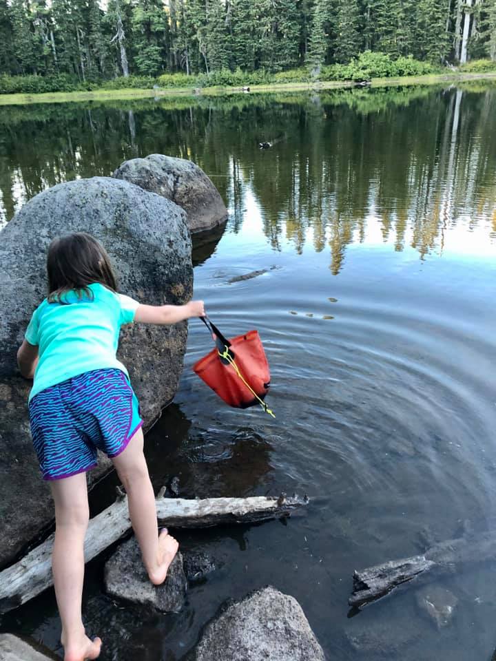
Checking out the Willamette River at Canemah Bluff
Now that you know how to hike in spring, how do you know where to hike with your family? No worries, I’ve got you covered. I’ve compiled my favorite spring hikes by book. Check them out below.
For springtime kid-friendly hikes in the Portland area, visit this page.
For springtime kid-friendly hikes in the Mt. St. Helens, Southwest Washington, Vancouver, and Clark County areas, visit this page.
For springtime kid-friendly hikes in the Columbia River Gorge, visit this page.
For springtime kid-friendly hikes in the Mt. Hood area, stay tuned for a future post.
We all spend a lot of time indoors during our wet Pacific Northwest winters. However, with the right gear and knowledge, you can make winter one of your favorite hiking seasons. Trails are less crowded, migratory birds are in the area, and waterfalls are full. That said, weather can be unpredictable, trails can be muddier, and there may be road hazards.
little feet hiking books have some great information on hiking in the winter. Read on for mom-tested tips on where to hike with kids in the winter, as well as ideas on how to hike safely with kids. Remember that you don’t have to travel far from home or spend a ton of time hiking to make it worthwhile. Even a short hike during the winter can be restorative and meaningful!
For winter hiking with kids, it can be good to stay lower in elevation, closer to cell service, and away from fire-damaged areas. It’s also a great idea to:
Plan for quickly changing weather. Check the weather the morning of your hike, but make sure you have extra layers for rain, wind, or hail. Consult WTA’s snow depth map when looking for snow conditions on a trail. Stay out of the forest when high winds are forecasted (rain plus wind can equal trees falling on roads and/or trails).
Dress in layers and avoid cotton. The combination of cold temperatures and rain can easily put you (and especially kids) in hypothermia territory.
Learn more about winter hiking from the Washington Trails Association (WTA).
Now that you’ve learned a bit on how to hike in the winter, how do you know where to hike with your family? Thankfully, I’ve compiled my favorite winter hikes by book. Check them out below!
Winter may feel a bit sleepy, but the jogging stroller friendly trail at Steigerwald takes you through an area busy with lots of wildlife. On any given winter day, you could encounter deer, birds of prey, ducks, geese, insects, and more. There are also Mt. Hood and Columbia River views. You can hike as little as 2 miles round trip to get a great nature experience, but there are also miles to add on once you connect to the Columbia River Dike Trail. This trail is a family favorite – just be prepared for the possibility of lots of wind while hiking here.
Hike 9 in little feet hiking:Ridgefield National Wildlife Refuge – Oaks to Wetlands Trail
Winter is the best time to visit the refuge because of all the migratory birds! You don’t have to walk very far on this easy 2 mile out-and-back trail to see and hear the noisy and beautiful swans that flew south (to our area) for the winter. Along the trail, you may even come across deer, birds of prey, ducks, and more. Bring a pair of binoculars and be sure to stop to read any interpretive signs. Consider a drive on the nearby Auto Tour Route to see even closer-up views of winter waterfowl and birds of prey. There is a fee to park.
Hike 16 in little feet hiking: Bells Mountain Trail from Cold Creek Day Use Area
This hike in the Yacolt Burn State Forest is only 27 miles from downtown Vancouver, yet it feels like it is deep in the wilderness. I love this trail in the winter because there is such a deep forest feel that is even more special in the rain. There is so much green from the trees that you totally forget that the skies are gray, and the sound of the rushing creek is quite soothing. The trailhead is down a gravel road, and there is no cell service, so you’ll need to plan to be a little off the grid. A WA Discover Pass is required to park.
La Center Bottoms is an excellent place for birdwatching, especially for migratory swans and pintail ducks. The trail can be a little muddy, especially when the gravel/dirt trail turns to dirt after the first half mile. You can continue on a dirt trail for another half mile for a 2 mile total round-trip hike. Favorite parts of this trail include multiple bird blinds and fun statues near the trailhead.
Our family loves this trail as it is rarely busy, there are always cool things to see, and we sometimes see horses! The trail starts out by crossing the creek on a long bridge, hiking through pretty forest (with some impressive nurse logs), and then taking you through a young forest that feels like a wild holiday tree farm. It has been neat to watch the trees grow on this trail over the last 10 years. There are also a lot of large cut stumps that allow for learning about dendrochronology (the study of tree rings). A WA Discover Pass is required to park.
In the winter, there is a lot of water flowing through Lacamas Park and over Lower Falls, which makes it really cool to hike to the falls this time of year. Between the pretty forest, the downed logs that are perfect for climbing, the wide stroller-friendly trail, and the bridge over the rushing creek, it’s a fantastic place to hike with kids. My favorite part of the trail, though, is the rocks. Did you know they are millions of years old? Learn more about that in my book.
The short hike to Little Zigzag Falls is great any time of the year, but my family really enjoys it when there is just a touch of snow on the ground. The trailhead sits just above 3,000 feet in elevation, so the trail has snow much of the winter. I’m not a huge fan of driving in snow or ice, but the access to this particular trailhead is less challenging than other higher-elevation Mt. Hood hikes. Be sure to read up on winter driving, and follow chain rules. As always, come prepared with your essentials and anything else you might need for a cold, icy/snowy adventure. Thankfully, there is a traffic camera on Highway 26 right by the trailhead. Find the traffic camera for Highway 26 at USFS Rd 35 here.
I love hiking at Wildwood Recreation Area on a rainy day! This awesome BLM recreation area has several miles of flat, kid-friendly trails (most of which are paved or boardwalk) and is located on the west slope of Mt. Hood. This spot is at about 1,200 feet, which means that it should stay snow-free most of the winter. When visiting, be sure to check out the relief map, the river beach, the naturalist exhibits on the boardwalk, and the awesome nurse logs along the paths. FYI, some of the boardwalks can be slippery when wet! There is a fee to park.
If you’ve ever wanted to hike through a fairy forest, the Old Salmon River Trail in Welches is the place to visit. You can hike up to 3.8 miles out-and-back along the river through a mossy old-growth forest. There are multiple parking areas and every section of this trail is beautiful. Plan on playing by the riverbank and climbing on and hugging massive trees. Keep an eye on kids around drop-offs and the swift river. This hike is accessible most of the year, as long as snow levels aren’t too low.
The Columbia River Dike Trail is a popular trail, but you will find fewer crowds in the winter. Winter is a fantastic time to hike, especially on cold, sunny days. Kids always seem to enjoy checking out the interpretive signs, hanging out in the dugout canoe replicas, climbing on low-hanging trees, and birdwatching. You might even see horses along the trail. Look for a view of Mt. Hood to the east on sunny days, and be prepared for windier conditions along the river.
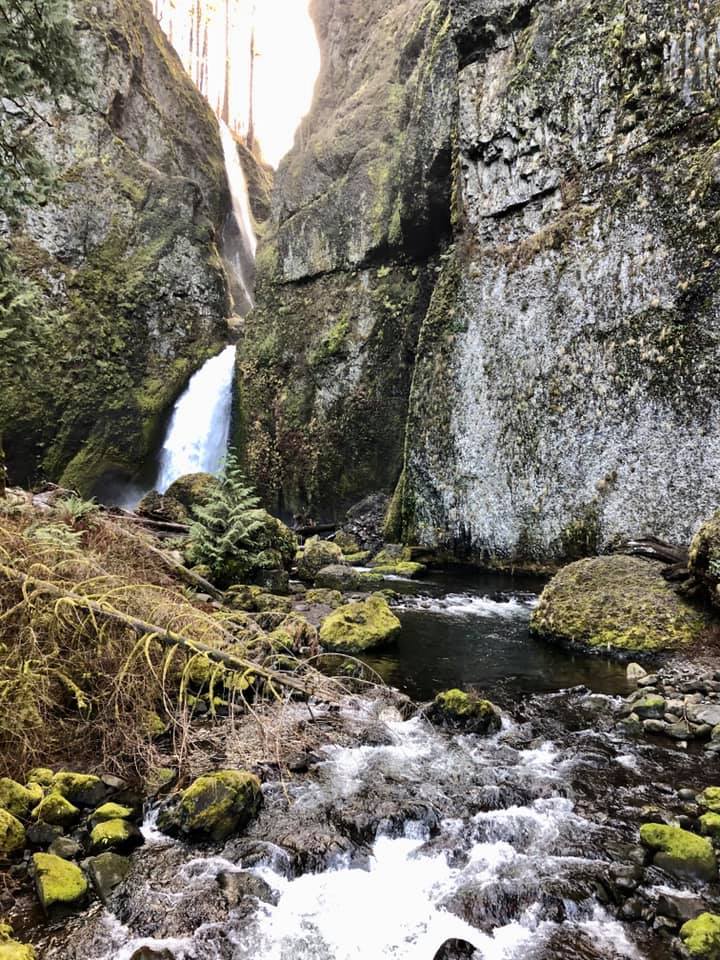
We love this hike because you can hike right up to two waterfalls on a somewhat challenging 2.4 mile loop hike. This hike is a Gorge treasure and is appropriate for kids who can navigate steep trails that are slippery when wet and are narrow with drop-offs. There are great Gorge views as well as fun trees to climb on and walk through. Be prepared for the cold sensations of waterfall spray as you make your way around the loop. The trail can get muddy, so use caution near cliff edges. This is one of the few hikes on the Oregon side of the Western Gorge that has not been affected by the 2017 Eagle Creek Fire. Fire-stricken areas are prone to dangerous mudslides during times of heavy rain, ice, and snow. That said, you still need to pay attention to recent weather events, as they can still destabilize any of the slopes in the Gorge.
This hike is one of the best in the eastern Gorge for late winter wildflowers. This nature preserve has amazing Gorge views and reliably has purple and white grass widows blooming in late February. In general, the area sees more sunshine in winter due to the rain shadow effect, making its a great destination for the winter blues. Just remember to check the latest forecasts, as the Gorge is prone to ice storms and low-elevation snow during the winter. Please respect this Nature Conservancy property by keeping your pets at home, staying on the trail, not picking the flowers, and using the boot brush at the beginning of the hike. As always when hiking in this part of the Gorge, keep an eye out for poison oak and ticks.
Most people know about amazing Forest Park, but it is hard to know where in the park to hike with kids. This fun loop takes you through a less-crowded section of Forest Park. On your hike, you’ll encounter pretty forest and lots of muddy track traps to help you track any wild animals that may have traversed the trail earlier. Read more about animal track and track traps in my book.
Hopkins Demonstration Forest is a lovely 140-acre privately owned forest near Beavercreek that is open to the public for hiking. There is a variety of trails here that take you past a pond, a creek, a log house, a fire lookout, and more. There are also interpretive features that teach out about the various habitats onsite. I like this property in the winter because there is so much green by way of fir needles, ferns, and other evergreen plants. There isn’t great cell service here, so make sure you know the way before leaving town.
This Metro park is a fantastic place to hike in winter. You’ll often encounter deer amongst the oak savannah and ponderosa pines, and there are interpretive signs along the trail. On a sunny day, you can even spy a view of Mt. Hood. You can hike up to 3.2 miles, and there are some hills to get your blood pumping. Leave some time at the end of your hike to play on the nature playground. No dogs are allowed at this park.
I hope you have a wonderful winter season out on the trails. Be safe and have fun!Be sure to follow little feet hiking on Facebook and Instagram for trip reports.
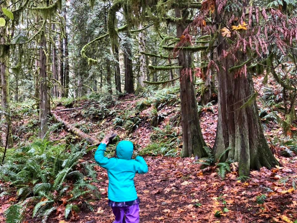
September hits and so does school, homework, soccer practice, after-school activities, social engagements, etc. That is an abrupt change to spending our days swimming, camping, hiking, riding bikes, and going to outdoor festivals. It has always been hard for me to make this change, especially because fall is so lovely in the Pacific NW. The rain doesn’t really hit hard until sometime in the middle of November, which means we have several months of ideal weather. So, why spend it all inside?
Getting outside with our kids once school starts up is certainly a challenge. It is important, though. Studies show that getting outside helps our kids’ mental and physical health. It can also help kids while they are at school by reducing stress, improving focus, and more. Add in some screen-free family connection, and there are endless benefits.
The nice thing about getting outside with kids is that it doesn’t need to be Instagram-worthy (and I would argue that we need to normalize local, low-key outdoor activities with our kids)! Any amount of time or location outdoors WILL be beneficial. You’ve got 15 minutes? Get outside! You can certainly fit that in most days.
Here are a few ideas for getting kids outside once the school year kids off:
Take advantage of early release days
Take after-dinner walks or bike rides until the time changes in November
Backpacking with my daughter is a favorite past-time of mine, and I know other families enjoy it too. I also know that it can be hard to know where to go backpacking with kids. Below are some trails in SW Washington and around Mt. Hood in my books that I know work for backpacking with kids.
Thomas Lake / Blue Lake – there are designated campsites in the Thomas Lake area about 0.6 mile in; there are designated campsites around Blue lake at 3.3 miles in; avoid this trail in early summer due to mosquitoes
June Lake – there are campsites at the lake around 1.25 mile in; no overnight parking is allowed at the trailhead, but there are some old roads and pull-outs near the access road (this will add a little extra mileage)
Salmon River Trail – there are campsites along the river at around 1.5 and 2 miles in
Burnt Lake – there are several campsites at the lake at 3.3 miles and 1400 feet gain in
Mirror Lake – there are multiple campsites at the lake at 2.2 miles in and 650 feet gain in
Hidden Lake -there is one campsite near the lake at 2 miles in and 700 feet gain into the hike
Lower Twin Lake – there are multiple sites at Lower Twin Lake 2 miles in (although you may need to hike along the additional 0.75 mile lake loop to find a site); there are more sites at Upper Twin Lake 0.7 mile from Lower Twin Lake
Catalpa Lake – after coming to the lake, hike to the right and find the campsite 0.75 mile from the trailhead
Buck Lake – there are multiple sites at the lake 0.5 mile from the trailhead
Meditation Point – there are several sites and a vault toilet at this walk-in campground 0.8-1.5 miles from the trailhead, depending on where you start your hike (0.8 mile from NF-5890 and 1.5 miles from the West Shore Day Use Area); learn more here
Boulder and Little Boulder Lakes – there are multiple campsites at both lakes, 0.3 miles from the trailhead to Boulder Lake and 1.2 miles from the trailhead at Little Boulder Lake; Little Boulder Lake is less busy than Boulder Lake
Badger Creek – there are at least 4 campsites within the first 3 miles of the hike
Oval Lake – there are several campsites by the lake, 2 miles from the trailhead
If you need some ideas on how to get started, check out these links too:
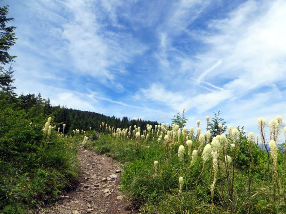
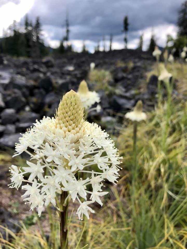
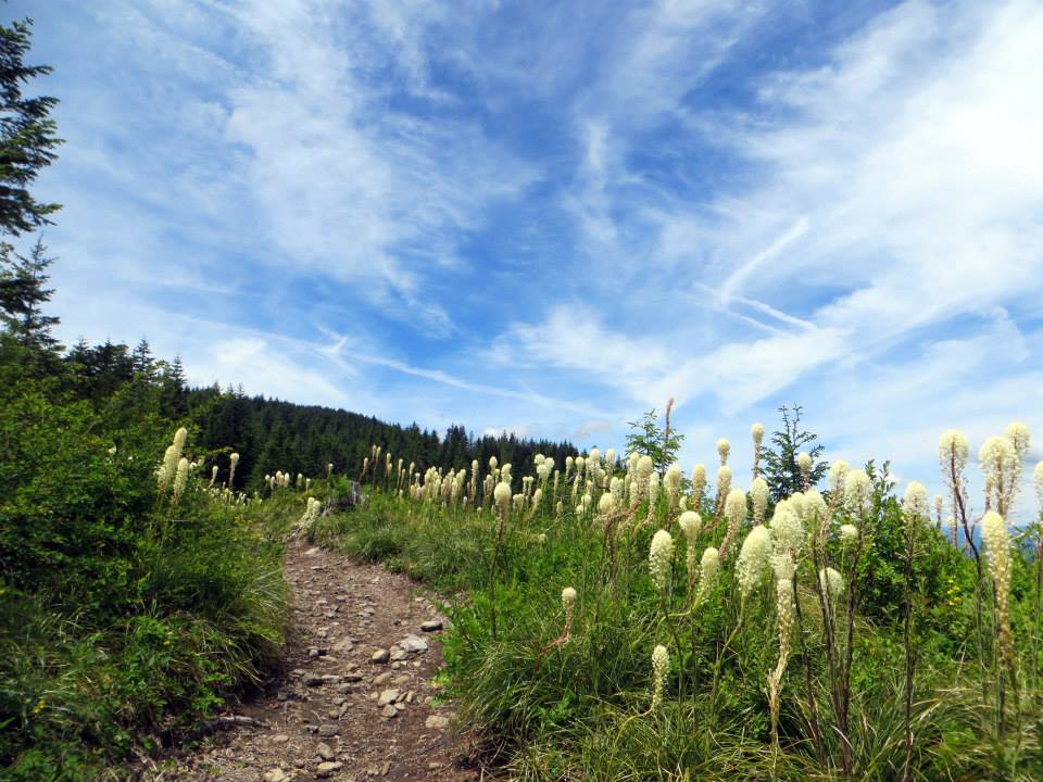
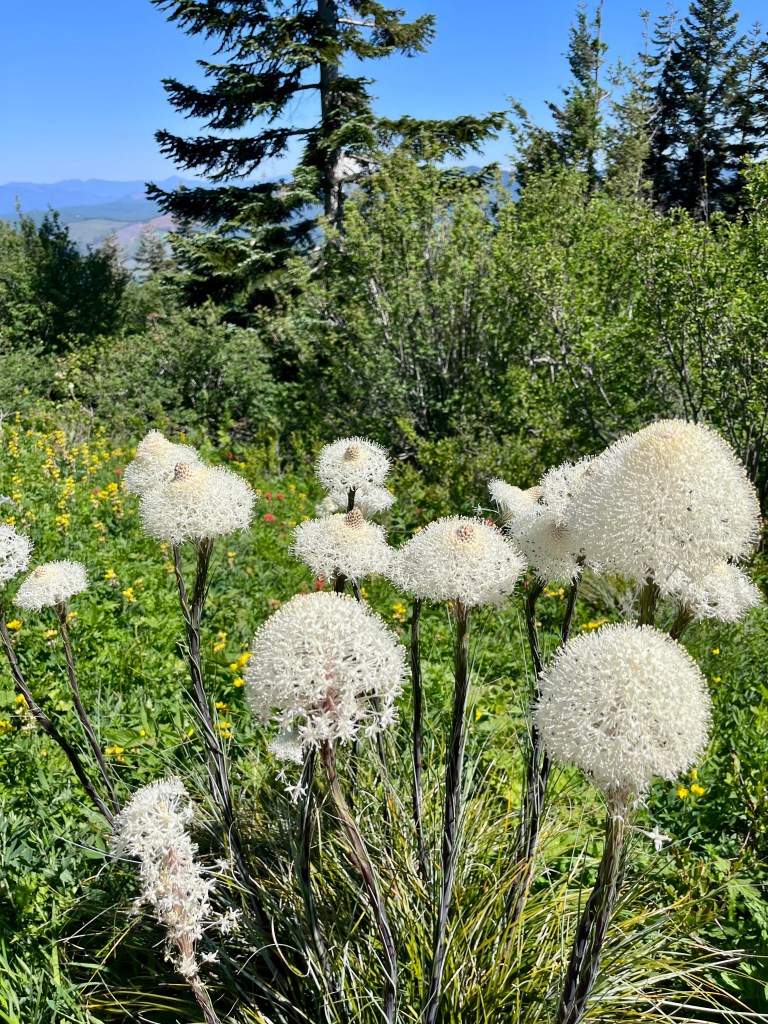
Since I moved to the PNW almost 20 years ago, I have loved beargrass. My kiddo has always loved it too. I’m not sure why – the flowers are kind of stinky if you get your nose up in there! Is it because they look like white truffala trees? Or maybe it’s because when you look at beargrass flowers up close, you see that the flower is actually lots of little flowers that come together to make one big flower. It may just be one of those things that might not be too exciting until you catch a superbloom. I’ve been fortunate enough to experience quite a few big beargrass blooms, and I think THIS YEAR is primed to be an excellent year for enjoying these beautiful flowers.
Every few years, there is an epic beargrass bloom in the higher elevations in June and July. It’s totally unpredictable. I have always heard that each plant will bloom every seven years, but research shows that the plant will bloom whenever spring rainfall is adequate. Beargrass (latin name: Xerophyllum tenax) is an evergreen perennial flowering plant that is native to the Western Unites States. Beargrass is actually not a grass at all, but instead it belongs to the bunchflower or Melanthiaceae family. Beargrass can grow up to 5 feet tall with a long stalk and small white flowers in a cluster at the top. I’ve always been told that the plant is called beargrass because bears eat it but that is not true. Interestingly, members of the Lewis and Clark expedition in the 1800s referred to beargrass by this name due to its similarity to a plant that they called beargrass. Bears have been known to use the plant to make their dens and deer and elk are known to eat beargrass. Historically, local indigenous groups have used beargrass leaves to weave watertight baskets and beargrass roots to make poultices for wound treatment. Beargrass is also harvested commercially for use in floral arrangements.
Now that you know ABOUT beargrass, where can you find it with your kids this season? Read on!
Below are my favorite hikes where you are most likely to see beargrass blooming this June and July. No promises, but these are your best bets for kid-friendly hikes with plentiful beargrass. All of the photos were taken by me in June or July some time during the last 15 years.
Most of these hikes have specific risks like drop-offs, lack of cell service, challenging access roads, or remoteness, and you won’t find many kid-specific descriptions for these hikes. Not to toot my own horn here, but my books go into the greatest detail of any kid-focused description you might find on these hikes. Before heading out on any of these hikes, please pick up a copy on Amazon, at Vintage Books, at the Fort Vancouver Regional Library or at the Multnomah County Library.
Please educate yourself on the risks, recommended extra gear, maps, and other details I include in the book descriptions. Also, check snow levels, especially in the higher elevations on Mt. Hood. No one needs to get lost or hurt looking for beargrass!
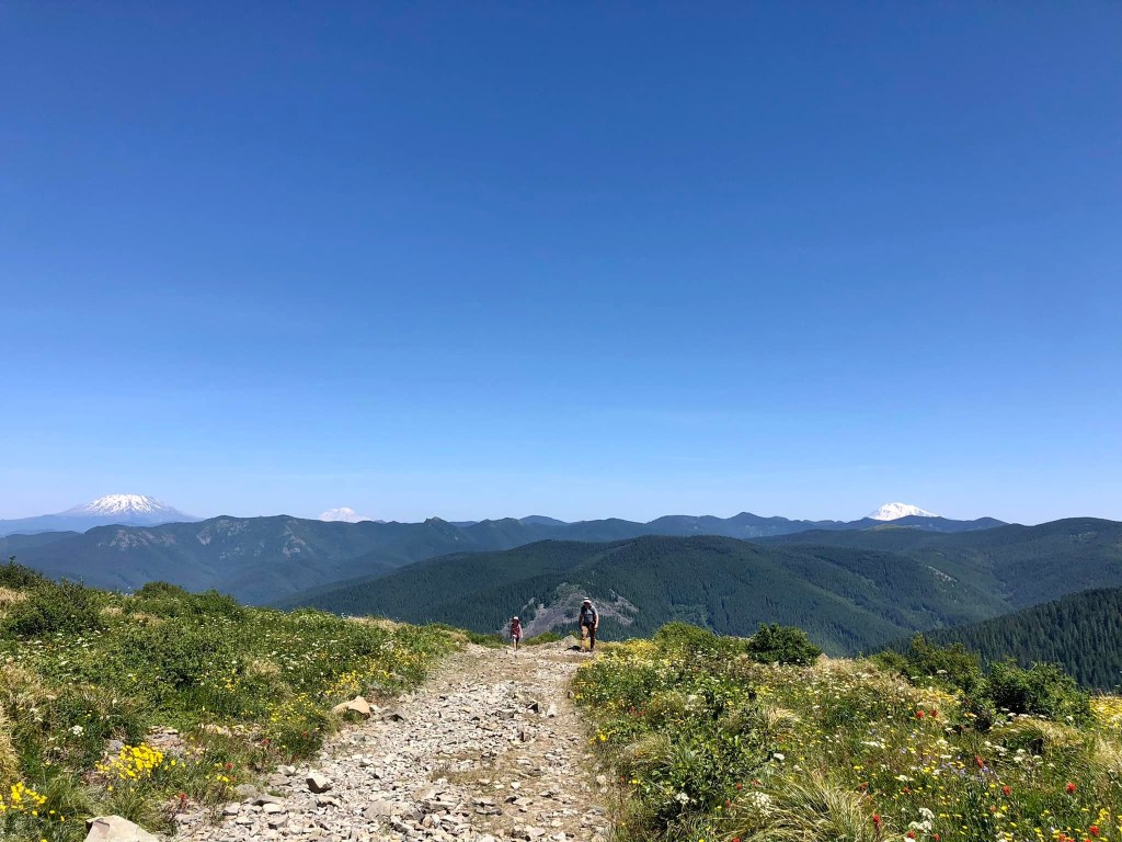
Heading up the trail with a few volcanoes (from left to right: Mt. St. Helens, Mt. Rainier, Mt Adams)
Have you heard of Silver Star Mountain in Southwest Washington? It’s one of the most unique places in the area, and it is known for its epic wildflower bloom and breathtaking views.
The issue for families is that the main approach from Grouse Vista Trailhead requires a one mile slog straight uphill on an old, steep, rocky road before you even getting any views. The north Silver Star trailhead takes off quite a bit of that elevation gain (and gives you views from the get-go), but the access road is historically one of the worst roads around. My family has been hiking on this mountain for 17 years, and it has been a long time since I’ve seen the road in good shape…until today! In the past, only very high clearance vehicles could make it to the trailhead, but today we saw SUVs and Subarus that made it to the trailhead just fine. The group Friends of Road 4109 has been instrumental in getting this road back in shape, and road work on the access road just started a few days ago. I think the trailhead will be even easier to access when they are done with the road work on June 30th.
All this said, the road will always be on the rougher side due to its location, exposure, and the types of vehicles that drive on it, especially after heavy rain or snow. Please use your discretion to determine how safe the road is for your vehicle and family, and be prepared to turn around/back up if necessary. If you do need to pivot, consider hiking the nearby Larch Mountain hike described in my first book little feet hiking. Keep an eye on the Friends of Road 4109 page for updates on trail conditions.
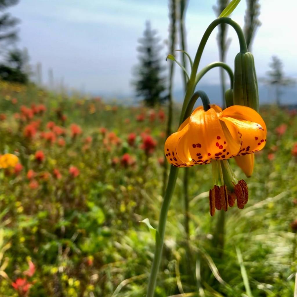
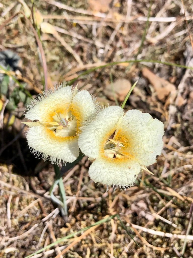
BeargrassMariposa liliesSwallowtail butterfly and tiger liliesColumbineLarkspurPenstemon and paintbrush
WHAT MAKES THIS PLACE SO SPECIAL?
First off, the views are amazing – unlike anything you can find in the area. This mountain is made up of volcanic rock and can be seen from many spots in the Portland/Vancouver Metro area. You won’t actually see Silver Star’s summit on any of the recommended routes in this description, but you will be ON the mountain!
The mountain is known for its wildflower bloom, which lasts all summer long. You’ll also encounter a lot of pollinators like bees, birds, hummingbirds, and butterflies. Please do not let kids pick the flowers and teach them about Leave No Trace principles. The area is also amazing in the fall due to the changing fall colors. Snow starts flying sometime at the end of October or beginning of November.
Please note that there are currently no guide books or online hike descriptions that outline a Silver Star hike specifically for kids. Please use any other hike descriptions with extreme caution. I will outline some risks below, but please know that this area is remote and there are a lot of risks involved if safe decisions aren’t made. This hike description is only relevant until snow starts falling. After that, this area is inaccessible for quite some time.
Epic wildflower bloom
THE HIKE: 1.2+ MILES ROUND-TRIP AND 500+ FEET OF GAIN WITH EXTENSION OPPORTUNITIES
From the trailhead, find a narrow trail next to a broken signboard. Follow this trail through a mix of sun and shade, and trees and flowers. There are steep drop-offs, but there is quite a bit of brush between the trail and the edge. The trail is a bit crumbly in spots, and extra caution should be exercised. After 0.3 mile, the trail connects up with the old road you saw at the trailhead. Sometimes people drive on this old road (even though they aren’t supposed to), so keep an eye and ear out. Hike uphill on the wide, rocky road for around 0.1 mile before coming to an epic ridgeline viewpoint of Mt. Hood and the valley below Silver Star Mountain. Don’t forget to look behind you to spy Mt. St. Helens, Mt. Rainier, and Mt. Adams! There are extreme drop-offs here, so you will want to stay far away from the edge.
At this spot, you’ll see a trail going off to the left and a sign for Ed’s Trail. This trail runs along the cliff’s edge and is absolutely not kid-friendly. Stay right and continue to follow the old road up a small hill and around a corner. At about 0.6 mile into your hike, you’ll see an old jeep road going uphill to the left and some neat rocks on the right (there are cliffs on the other side of the rocks, so do not get too close). This is a great turnaround spot.
Just before the jeep road extensionHeading up the jeep road extensionLooking back down on the jeep road extension climb
For a longer hike and some better views, you can head uphill on the old jeep road on the left. The trail comes to a saddle after about 0.2 mile. The trail continues past this, but the trail becomes narrower, rockier, and cliffier.
Continuing on Trail #180
You could also continue straight on Trail #180. The trail steadily climbs before heading into the woods about 1.5 miles from the trailhead. From here, the trail stays in the woods and continues to climb until reaching the summit. You can learn more about that approach here. My daughter summitted when she was 9 years old, but I know kids a little younger do that too. You have to really educate yourself on the hike, come prepared with good sun protection and lots of water, and regularly check in with you and your kids’ abilities.
Early-on view of Mt. Hood and the valley below Silver Star MountainSome cool rocks just before coming to the old jeep road
SOME THINGS/RISKS TO NOTE:
There is often garbage at the trailhead, so keep kids from walking through the old firepits or picking up broken glass, etc. There are also steep cliffs on one side of the parking area, and sometimes people drive on sections of the trail.
There isn’t much shade on this hike at all and you will be hiking at a higher elevation. The rocks can also reflect lots of heat back onto you. Bring more water than you think you’ll need and lots of sun protection. It is easy to twist an ankle or knee on the rocky and/or crumbly trail (especially on the downhill) and dogs will need to have really tough feet or booties. Hiking poles are recommended for stability. There are deadly drop-offs if you get too close to cliff edges on this trail. This isn’t a trail that you can let kids run around on. It is good to have an adult in front to make sure you can adequately prepare for the risks ahead. Kids hiking this trail will need to be able to follow direction for their own safety. Follow this hike description at your own risk. This is a helpful map to have before you set out.
DIRECTIONS:
Information on the Silver Star Trailhead can be found here. If you come from L1100 (which I would recommend until Forest Road 41 in the Gifford Pinchot National Forest is repaired), the road isn’t too bad until you get on Forest Road 4109. You’ll have 2.5 miles of rugged road as described earlier in this post. There are no passes required at the trailhead, which is just a big gravel pull-out.
LIABILITY:
The author assumes no liability for injuries sustained by or accidents happening to readers and their hiking companions who engage in the activities described in the write-up. Although the author has made every effort to ensure that the write-up’s information was correct at press time, the author does not assume and hereby disclaims any liability to any party for any disruption, loss, or damage caused by errors or omissions, whether such errors or omissions result from negligence, accident, or any other cause. Mileages and elevation gain are rounded and can change based on the tool used to measure. Hiking poses some inherent risk. The author advises readers to take full responsibility for their safety and that of their children and know everyone’s limits. The author is not an expert. Before practicing the skills described in this hike description, be sure that your equipment and gear are well maintained, and you do not take risks beyond your level of experience, aptitude, training, and comfort level. The author makes her best attempt at outlining risks such as toxic plants, cliffs, dangerous animals, and hazardous water, but there are likely risks on these trails that are not noted.
With so many families out hiking, I wanted to post my book’s safety tips so that everyone can see them. While this post does not address everything you need to know about safely hiking with kids, I hope it gets you started.
SAFETY IDEAS:
Below are my most important safety recommendations to prepare for a hike:
ALWAYS, ALWAYS, ALWAYS tell someone where you are going, when you will be back, and if you can, tell them what authorities to contact if you do not check in by the time you say you will. I usually assume one mile per hour and often add an hour or two in case I decide to stay a little longer on the trail or make a stop on the way home.
Try not to hike alone if you are outside of cell service range.
Respect fire closures! More is written on this below.
Give your kiddo a backpack with gear or at the very least, a whistle with a lanyard that goes around the neck. Talk to them about what to do if they get lost (more on this later in this section).
Pay attention to how far in you have hiked and be prepared to carry your kiddo back if you hike in too far or someone gets injured
Keep yourself and your kiddo dry, fed, and hydrated
Know what the weather is supposed to be for the next few days and plan for inclement weather (it changes quickly in the Pacific Northwest); visit www.weather.gov and type in the closest town to your hike and then click on your hike location to get the most accurate weather information
Know your route to the trailhead, including alternate routes and check conditions before you leave, including 48-hour weather forecasts
Know where to find the closest gas station to the trail and what cell service is like
Pre-read the hike descriptions so you know what to expect.
Bring as many of the 10 essentials for you and your kids as you can and know how to use them in an emergency (I write more about this below).
In addition to the above tips, here are my suggestions on how to stay safe while on the trail.
The big things parents can advise kids on are:
Not to put anything in their mouths except for food you have given them
Not to run ahead out of sight
Stop at all trail junctions (where two or more trails come together)
Walk slowly and mindfully when conditions are steep, rocky, downhill, or wet
Stay on the side of the trail away from cliffs and look in the direction they want to hike
Do not run, jump, skip, or hop near ledges or on rocky trails
I advise parents to:
Be prepared and consider possible hiccups
Carry a quality first aid kit and know basic first aid skills; consider carrying an emergency locator beacon
Know your and your kids’ abilities (and how far you can push them)
Be willing to turn around
Go with others (which saved me on the day I sprained my ankle a half mile from the trailhead on Mt. St. Helens!)
Stop at all trail junctions to orient and review maps and hike descriptions before proceeding; you can involve kids in this early on so this becomes a habit
Point out toxic plants and advise on consequences if appropriate
Remember that temperatures will be cooler at higher elevations
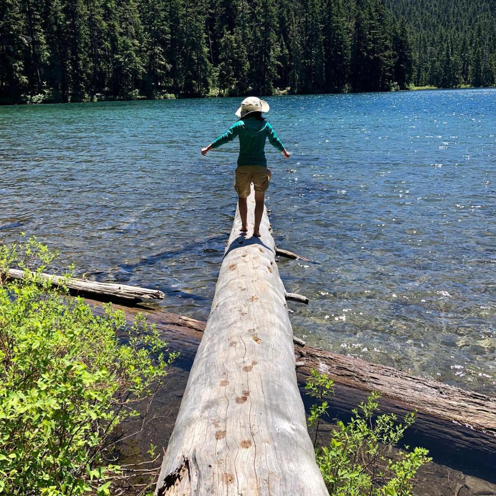
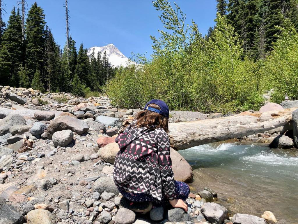
Rivers and Lakes:
It is important to know that the rivers and creeks in the PNW are swift and cold, and the lakes range from cold to warm depending on the time of year. There are usually no lifeguards and extra care needs to be taken near water, especially around fast-moving rivers and creeks.
Insects:
You will encounter different insects depending on when you visit the areas in the PNW. In general, mosquitoes seem to be less of a problem near rivers, but you should always be prepared to encounter them, especially if hiking near still water. In late summer, you may encounter stinging insects like wasps and hornets. Use caution around the bases of trees and keep an eye out for nests and an ear out for buzzing. You may encounter ticks, especially east of the Cascade Locks area. I have encountered them west of Cascade Locks. It’s always good to do a tick check after every hike, but especially in the spring and year-round hiking east of Cascade Locks. It is a quick and easy habit to prevent having to remove one later. You can learn more here: https://americanhiking.org/resources/ticks.
Toxic Plants:
There are many plants in the woods that are toxic. However, once you start looking into it, most of the plants in your yard are as well (like rhododendrons and rhubarb leaves)! Poison hemlock, many mushrooms, chokecherry, baneberry, and nightshade are some deadly plants you should know about. These plants are not too prevalent, but they do occur in Pacific Northwest forests. I recommend familiarizing yourself with these and other toxic plants. Many plants have colorful berries in late summer and if ingested, will make kids ill but are not necessarily deadly. I have a “no picking of berries” rule. There are some wonderful edible wild berries, but I have instructed my kiddo to point out the berries, ask if they are edible, and then I advise from there. We also have a “no touch” policy on mushrooms.
Dogs:
When meeting dogs on the trail, I have kiddos step off the trail and wait for dogs to pass. Kids should only approach dogs after asking you and the owner if it is okay. Kids should stand above dogs and not kneel down at eye level.
Wild Animals:
You probably know that there are wild animals in the woods (cougars, bears, coyotes, deer and elk, oh my!). Attacks by wild animals are rare in Oregon and Washington, but if you are on a trail where you might encounter these animals, make sure you do not hike alone with your child, make noise, and avoid trails early in the morning and at dusk. This is another reason not to let kiddos run ahead on sparsely populated trails. You can mitigate this by having more than one adult who can take the lead while another adult acts as a caboose. Read up on what to do if you encounter a variety of wildlife here: www.dfw.state.or.us/wildlife/living_with and consider carrying bear spray, whistles, and hiking poles to help scare away an animal.
Lost Kids:
While uncomfortable to discuss, getting lost can happen. Your entire family can avoid getting lost by staying on the trail, carrying a map, and stopping at all trail junctions to confirm that you are where you think you are. Include children in checking maps and identifying your location.
It is important to talk to kids at home and at the beginning of the hike on how to avoid getting lost and what to do if they get lost. Strategies for preventing a lost child include:
Not letting kids run ahead out of sight (tell them they have to stay close enough to see an adult)
Not letting kids leave the trail without an adult
Giving kids a whistle that hangs from a lanyard
Dressing kids in bright clothing
Discussing the importance of stopp
You can also prepare them for being lost by teaching them the following:
Only blow your whistle if you need help (instead of for play)
If you get lost, hug a tree, stay put, and call out or blow your whistle 3 times in a row every few minutes.
It is much easier to find someone who is lost if the only people moving are the searchers
How to use what is in their pack and even practice at home
If your kids get lost, you can aid in their recovery by giving them a backpack to wear with extra food, water, and clothing, a small first aid kit, a flashlight, a large garbage bag or poncho (for raincover) and a notecard with emergency contact information.
It can be scary for kids to talk about getting lost, but discussing how to avoid getting lost and what to do if you get lost is very empowering for kids. Check out this website: https://westvalleysar.org/wilderness-safety/hug-a-tree. Don’t be scared, be prepared!!
GEAR IDEAS:
It is best to plan for “a day hike gone bad,” especially if you will be on a trail without cell service or one that is far away from resources.
When leaving for a hike, I don’t leave the house without:
The 10 Essentials (see below)
Personal Locator Beacon and Garmin Inreach
Physical road map (because cell service is not always available and mapping services are not always reliable)
Bear Spray
Change of clothes and extra socks
Food and water for the trip home
So what are the 10 Essentials and why do people talk about them so much? The 10 Essentials are the top ten things you should need to survive a night out in the woods. They are:
Navigation – map, GPS, compass
Light – headlamp or flashlight with extra batteries
Sun protection – sunglasses, sunscreen, sun-protective clothing like a hat
First aid kit (make sure to include insect repellant and children’s medications)
Knife or multi-tool
Fire – matches, lighter, magnesium/flint
Shelter – tarp, emergency blanket
Extra food – bring more than you need and consider lightweight high-calorie protein bars
Extra water – bring more than you need and consider carrying water purification tablets and/or water filter or lifestraw
Extra clothes – for warmth, bring a hat and a warmer layer; I pack my bag for overnight temperatures
Regarding clothing, I dress kiddo in bright colors so I can keep a better eye on her amongst the colors of the forest. Remember that “cotton kills” in our climate during the rainy months (check this site out for more information: https://sectionhiker.com/why-does-cotton-kill). For a typical November day, I layer my kiddo with synthetic base layers (long underwear), fleece pants, fleece pullover and then a waterproof trail suit or rain jacket and rain pants. Wool is a natural alternative to fleece if you are not sensitive to it like me. You will need to keep an eye on whether your kiddo is sweating and de-layer before that happens (check in after climbing a bit or if you feel yourself getting too warm). Getting wet is a no-no in winter here (see the link above about cotton). These rules apply to socks too. When temperatures are warmer, I tend to stick with wicking clothing for quick drying if kiddo sweats or plays in water. Remember that warm days can still have cool mornings and evenings so always bring warmer layers when hiking in the mountains. Check out this link for good ideas: https://raisinghikers.com/how-to-dress-kids-for-winter-hikes/.
Sun protection is also super important all year long due to the angle of the sun in our Oregon sky. Sturdy well-fitting shoes with good traction are important but dedicated hiking shoes can assist when trails are wobbly or rocky. Bring a pair of kids sandals if you think they might want to play in boggy lakes.
If you can, get your kiddos their own backpacks and water bottles/bladders. This will make hiking even more exciting! Have your kiddos carry their own snacks, water, and layers, but make sure not to weigh them down with too much gear. Experts disagree, but a good rule of thumb is that kids over 4 years old can carry 5-15% of their body weight. Remember to account for the weight of water and the pack itself. For younger kids, you can just let them wear their backpacks with nothing in it to get them used to it.
A single toy or doll to accompany your kiddo on the hike can always be a fun motivator and source of comfort. Bring extra clothes, snacks, and water for the ride home. A travel potty, extra socks,towels, and wet wipes for wiping off trail dirt are always a great idea. You may want to bring a backup kid carrier on your hike if you think you might need to carry your kiddo out.
We all spend a lot of time indoors during our wet Pacific Northwest winters. However, with the right gear and knowledge, you can make winter one of your favorite hiking seasons. Trails are less crowded, migratory birds are in the area, and waterfalls are full. That said, weather can be unpredictable, trails can be muddier, and there may be road hazards.
little feet hiking books have some great information on hiking in the winter. Read on for mom-tested tips on where to hike with kids in the winter, as well as ideas on how to hike safely with kids. Remember that you don’t have to travel far from home or spend a ton of time hiking to make it worthwhile. Even a short hike during the winter can be restorative and meaningful!
For winter hiking with kids, it can be good to stay lower in elevation, closer to cell service, and away from fire-damaged areas. It’s also a great idea to:
Plan for quickly changing weather. Check the weather the morning of your hike, but make sure you have extra layers for rain, wind, or hail. Consult WTA’s snow depth map when looking for snow conditions on a trail. Stay out of the forest when high winds are forecasted (rain plus wind can equal trees falling on roads and/or trails).
Dress in layers and avoid cotton. The combination of cold temperatures and rain can easily put you (and especially kids) in hypothermia territory.
Learn more about winter hiking from the Washington Trails Association (WTA).
Now that you’ve learned a bit on how to hike in the winter, how do you know where to hike with your family? Thankfully, I’ve compiled my favorite winter hikes by book. Check them out below!
Winter may feel a bit sleepy, but the jogging stroller friendly trail at Steigerwald takes you through an area busy with lots of wildlife. On any given winter day, you could encounter deer, birds of prey, ducks, geese, insects, and more. There are also Mt. Hood and Columbia River views. You can hike as little as 2 miles round trip to get a great nature experience, but there are also miles to add on once you connect to the Columbia River Dike Trail. This trail is a family favorite – just be prepared for the possibility of lots of wind while hiking here.
Hike 9 in little feet hiking:Ridgefield National Wildlife Refuge – Oaks to Wetlands Trail
Winter is the best time to visit the refuge because of all the migratory birds! You don’t have to walk very far on this easy 2 mile out-and-back trail to see and hear the noisy and beautiful swans that flew south (to our area) for the winter. Along the trail, you may even come across deer, birds of prey, ducks, and more. Bring a pair of binoculars and be sure to stop to read any interpretive signs. Consider a drive on the nearby Auto Tour Route to see even closer-up views of winter waterfowl and birds of prey. There is a fee to park.
Hike 16 in little feet hiking: Bells Mountain Trail from Cold Creek Day Use Area
This hike in the Yacolt Burn State Forest is only 27 miles from downtown Vancouver, yet it feels like it is deep in the wilderness. I love this trail in the winter because there is such a deep forest feel that is even more special in the rain. There is so much green from the trees that you totally forget that the skies are gray, and the sound of the rushing creek is quite soothing. The trailhead is down a gravel road, and there is no cell service, so you’ll need to plan to be a little off the grid. A WA Discover Pass is required to park.
La Center Bottoms is an excellent place for birdwatching, especially for migratory swans and pintail ducks. The trail can be a little muddy, especially when the gravel/dirt trail turns to dirt after the first half mile. You can continue on a dirt trail for another half mile for a 2 mile total round-trip hike. Favorite parts of this trail include multiple bird blinds and fun statues near the trailhead.
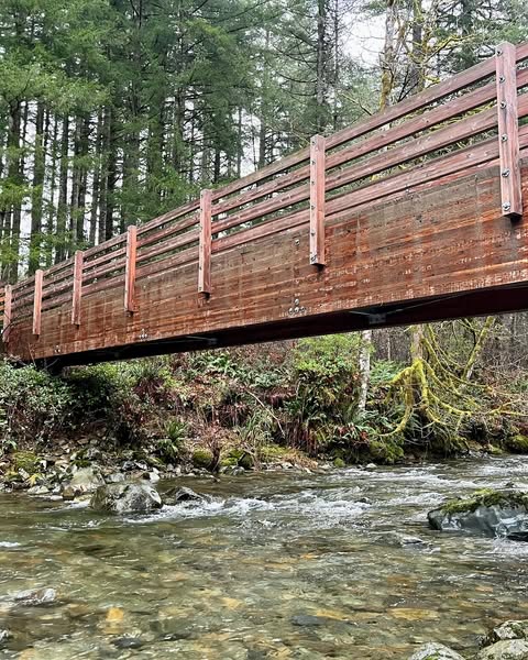
Our family loves this trail as it is rarely busy, there are always cool things to see, and we sometimes see horses! The trail starts out by crossing the creek on a long bridge, hiking through pretty forest (with some impressive nurse logs), and then taking you through a young forest that feels like a wild holiday tree farm. It has been neat to watch the trees grow on this trail over the last 10 years. There are also a lot of large cut stumps that allow for learning about dendrochronology (the study of tree rings). A WA Discover Pass is required to park.
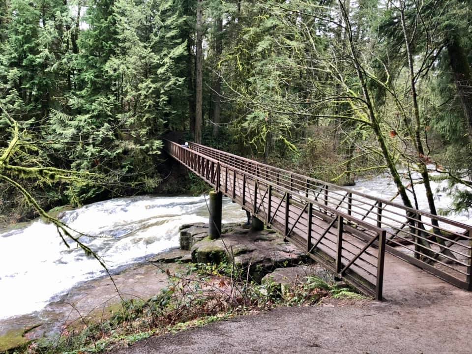
In the winter, there is a lot of water flowing through Lacamas Park and over Lower Falls, which makes it really cool to hike to the falls this time of year. Between the pretty forest, the downed logs that are perfect for climbing, the wide stroller-friendly trail, and the bridge over the rushing creek, it’s a fantastic place to hike with kids. My favorite part of the trail, though, is the rocks. Did you know they are millions of years old? Learn more about that in my book.
The short hike to Little Zigzag Falls is great any time of the year, but my family really enjoys it when there is just a touch of snow on the ground. The trailhead sits just above 3,000 feet in elevation, so the trail has snow much of the winter. I’m not a huge fan of driving in snow or ice, but the access to this particular trailhead is less challenging than other higher-elevation Mt. Hood hikes. Be sure to read up on winter driving, and follow chain rules. As always, come prepared with your essentials and anything else you might need for a cold, icy/snowy adventure. Thankfully, there is a traffic camera on Highway 26 right by the trailhead. Find the traffic camera for Highway 26 at USFS Rd 35 here.
I love hiking at Wildwood Recreation Area on a rainy day! This awesome BLM recreation area has several miles of flat, kid-friendly trails (most of which are paved or boardwalk) and is located on the west slope of Mt. Hood. This spot is at about 1,200 feet, which means that it should stay snow-free most of the winter. When visiting, be sure to check out the relief map, the river beach, the naturalist exhibits on the boardwalk, and the awesome nurse logs along the paths. FYI, some of the boardwalks can be slippery when wet! There is a fee to park.
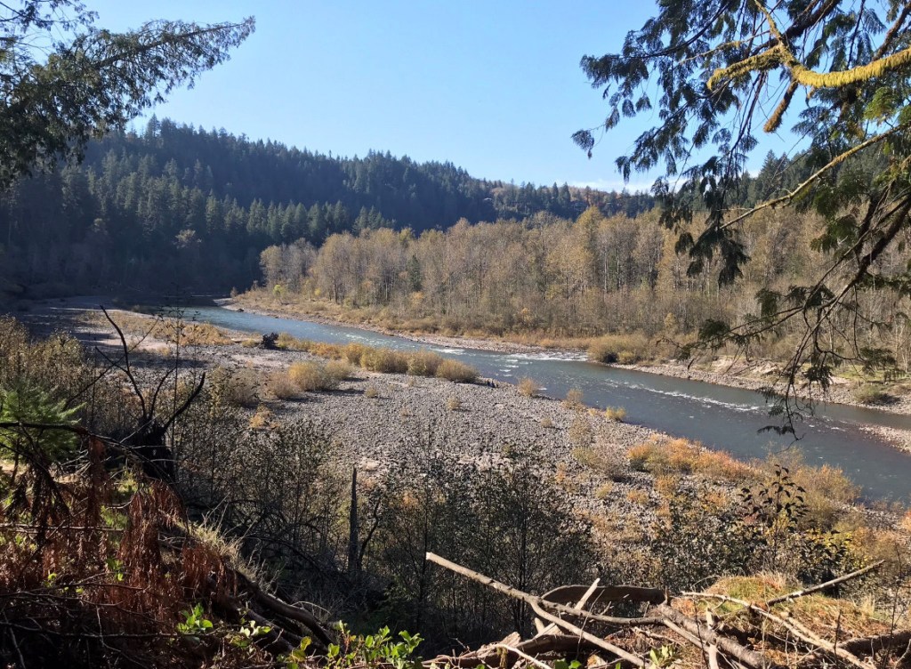
If you’ve ever wanted to hike through a fairy forest, the Old Salmon River Trail in Welches is the place to visit. You can hike up to 3.8 miles out-and-back along the river through a mossy old-growth forest. There are multiple parking areas and every section of this trail is beautiful. Plan on playing by the riverbank and climbing on and hugging massive trees. Keep an eye on kids around drop-offs and the swift river. This hike is accessible most of the year, as long as snow levels aren’t too low.
The Columbia River Dike Trail is a popular trail, but you will find fewer crowds in the winter. Winter is a fantastic time to hike, especially on cold, sunny days. Kids always seem to enjoy checking out the interpretive signs, hanging out in the dugout canoe replicas, climbing on low-hanging trees, and birdwatching. You might even see horses along the trail. Look for a view of Mt. Hood to the east on sunny days, and be prepared for windier conditions along the river.
We love this hike because you can hike right up to two waterfalls on a somewhat challenging 2.4 mile loop hike. This hike is a Gorge treasure and is appropriate for kids who can navigate steep trails that are slippery when wet and are narrow with drop-offs. There are great Gorge views as well as fun trees to climb on and walk through. Be prepared for the cold sensations of waterfall spray as you make your way around the loop. The trail can get muddy, so use caution near cliff edges. This is one of the few hikes on the Oregon side of the Western Gorge that has not been affected by the 2017 Eagle Creek Fire. Fire-stricken areas are prone to dangerous mudslides during times of heavy rain, ice, and snow. That said, you still need to pay attention to recent weather events, as they can still destabilize any of the slopes in the Gorge.
This hike is one of the best in the eastern Gorge for late winter wildflowers. This nature preserve has amazing Gorge views and reliably has purple and white grass widows blooming in late February. In general, the area sees more sunshine in winter due to the rain shadow effect, making its a great destination for the winter blues. Just remember to check the latest forecasts, as the Gorge is prone to ice storms and low-elevation snow during the winter. Please respect this Nature Conservancy property by keeping your pets at home, staying on the trail, not picking the flowers, and using the boot brush at the beginning of the hike. As always when hiking in this part of the Gorge, keep an eye out for poison oak and ticks.
Most people know about amazing Forest Park, but it is hard to know where in the park to hike with kids. This fun loop takes you through a less-crowded section of Forest Park. On your hike, you’ll encounter pretty forest and lots of muddy track traps to help you track any wild animals that may have traversed the trail earlier. Read more about animal track and track traps in my book.
Hopkins Demonstration Forest is a lovely 140-acre privately owned forest near Beavercreek that is open to the public for hiking. There is a variety of trails here that take you past a pond, a creek, a log house, a fire lookout, and more. There are also interpretive features that teach out about the various habitats onsite. I like this property in the winter because there is so much green by way of fir needles, ferns, and other evergreen plants. There isn’t great cell service here, so make sure you know the way before leaving town.
This Metro park is a fantastic place to hike in winter. You’ll often encounter deer amongst the oak savannah and ponderosa pines, and there are interpretive signs along the trail. On a sunny day, you can even spy a view of Mt. Hood. You can hike up to 3.2 miles, and there are some hills to get your blood pumping. Leave some time at the end of your hike to play on the nature playground. No dogs are allowed at this park.
I hope you have a wonderful winter season out on the trails. Be safe and have fun!Be sure to follow little feet hiking on Facebook and Instagram for trip reports.
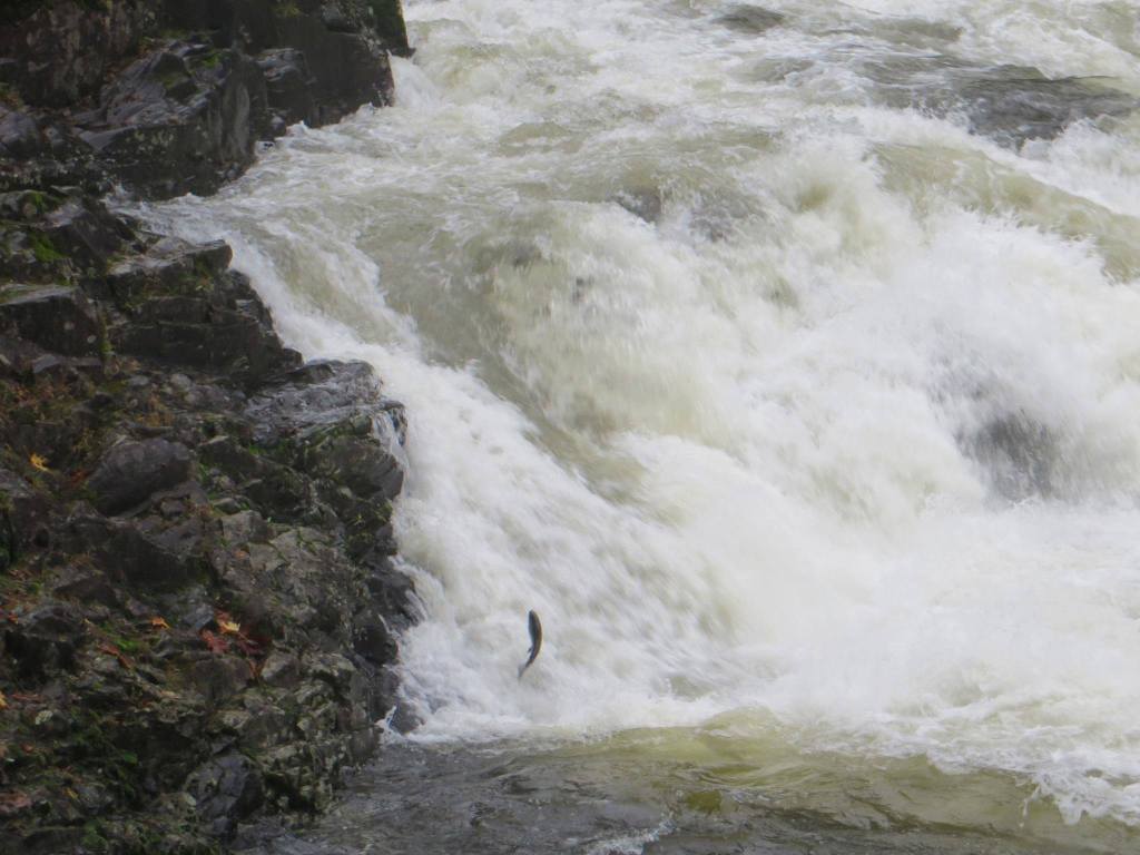
One of the most amazing natural wonders we encounter in the Pacific Northwest is the annual fall salmon run. Salmon need cold, clean water and large amounts of gravel or sediment to lay their eggs (spawn), which is why you’ll encounter them in some of our local creeks and rivers. Salmon spawn at the end of their lives – they spend 3 or 4 years out in the ocean before swimming back to the freshwater area where they were born. Watching fish complete this instinctual cycle is a sight to behold, and thankfully there are some kid-friendly places in the Portland-Vancouver area where families can witness this wonder.
Below is a list of the best places to take kids to see salmon spawning in the fall. Be sure to pick up a copy of the relevant little feet hiking guide to give you the best information for a safe, educational, and fun salmon-watching adventure.
P.S. Salmon poisoning is a thing for dogs. Look into this and keep dogs away from spawning areas for their safety.
Lucia Falls Regional Park
Easy stroller-friendly hike is appropriate for all ages, although littles will need help staying away from the rocks and walking through the parking lot
You will see salmon jumping the falls starting in late September and through the end of October at least (sometimes you’ll see into December)
Check out this video and this post to see salmon jumping there in October
You’ll also encounter lovely changing falls colors and neat mushrooms
Easy hike is okay for all ages but littles will need help staying out of the creek, walking through the parking lot, getting to the bottom of the waterfall, and not falling over the bridge above the waterfall
The hike starts from the Eagle Creek trailhead, which is one of the best places in the area to see salmon spawning
The Eagle Creek trail is not kid-friendly, but I’ve crafted a more kid-friendly hike starting at this trailhead and passing one of my favorite salmon spawning viewing spots
Best time to see salmon spawning here is late-September to mid-October
Mt. Hood with one of my favorite wildflower (western pasqueflower) in the foreground
I’ve recently discovered a new kid-friendly hiking route on Mt. Hood, and I just had to share it. I wish I had known about it before I had published little feet hiking: Mt. Hood, but at least I can share it with you here!
Hike Description for the Mt. Hood Meadows Timberline Loop:
Level 3
Trailhead Elevation: 3,720 feet
3.3 mile loop
Around 650 feet of elevation gain
Open summers
Popularity: Low on weekdays and Medium on weekends
Why Should You Check Out This Hike? This hike really has it all – amazing floral displays, creeks and a small waterfall, and mountain views. If you visit on a day that the lodge is open, there is also a restaurant and flush toilets available. There are no major drop-offs, but you may get your feet wet while crossing the creeks.
Kiddo hiking past false hellebore and paintbrush
Ways to Engage Your Kids:
Bring a field guide to identify summer flowers like lupine, paintbrush, beargrass, Douglas aster, goldenrod, false hellebore, and western pasqueflower
Play in the creeks
Pick huckleberries at the end of the summer
Look for Mt. Jefferson to the south
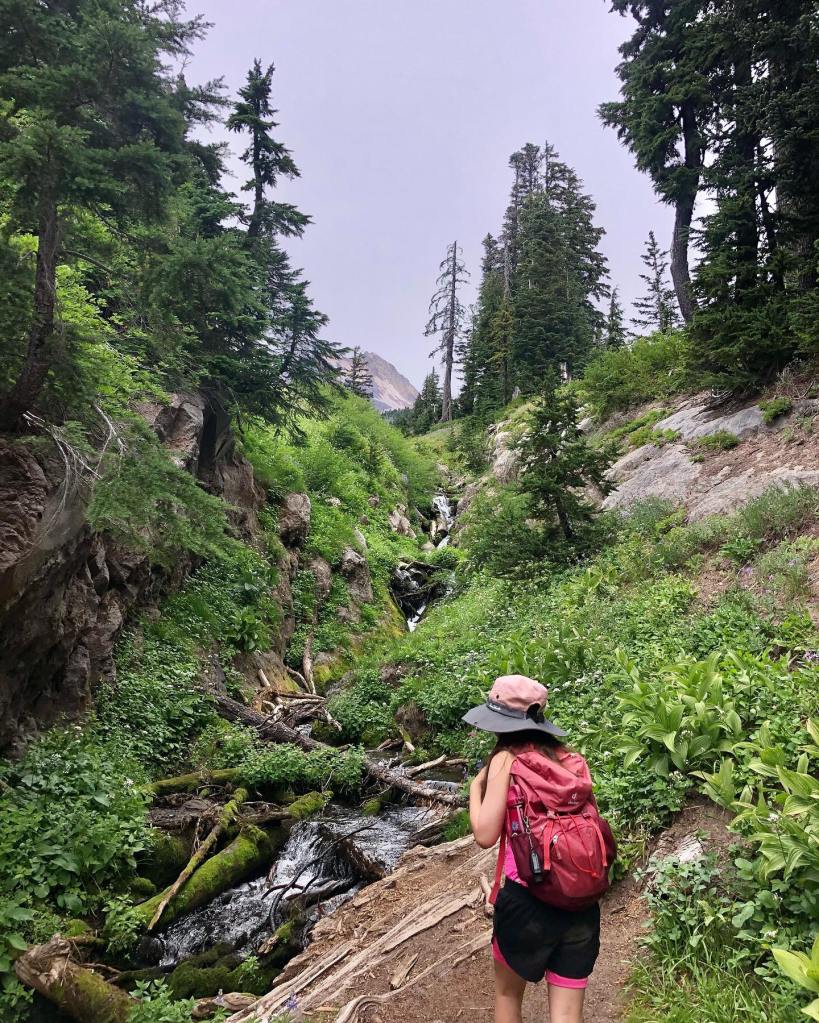
Checking out Pencil Falls
Trail Description:
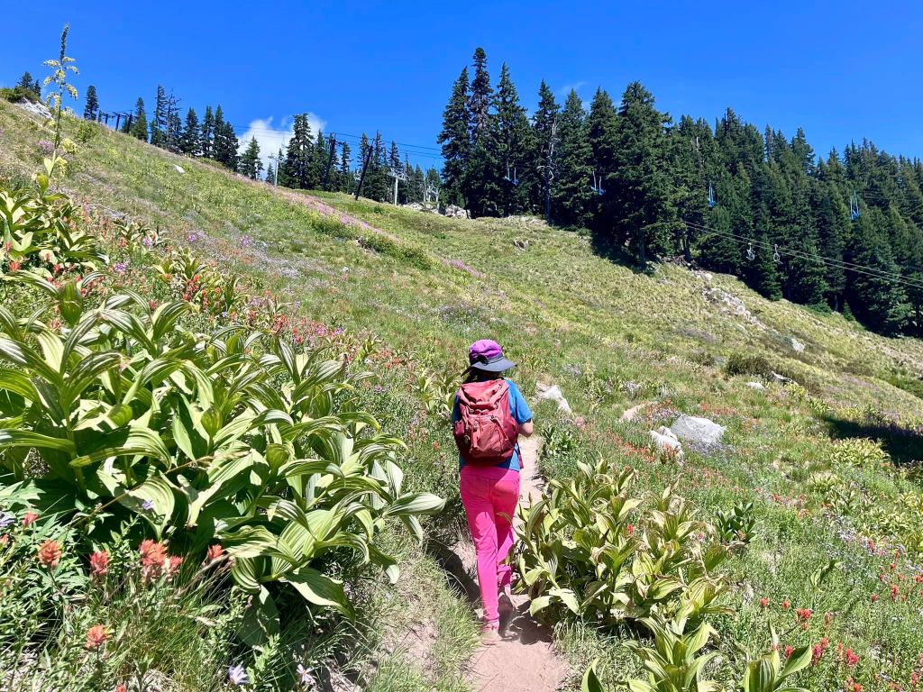
Walk towards the lodge and then walk alongside the building on its right side. Pass a little playground on the left, and then stay right at a junction. Continue following the service road as it heads towards the mountain and then hike right on Beargrass Trail #1 (see the map here). Follow the trail through meadows and under a ski lift before climbing a bit up to a junction with a service road. Turn left onto the service road and hike uphill. Stay on the road as you pass a service road on the left. At a junction, head left onto a different service road. Come to a junction with the Timberline Trail at 1.1 miles into your hike.
Head left (west) onto the Timberline Trail. This is where the hike gets really fantastic. On this trail, you will hike through a few creek crossings, past a pretty waterfall called Pencil Falls, in and out of colorful meadows, and alongside large rock walls. Hike on this trail for 1.1 miles before coming to a junction with a service road. Just past this junction, you will see a junction with the Umbrella Falls Trail. Turn left onto this trail. Hike through lovely woods and wildflower meadows for about 0.9 miles before coming to a junction with a trail. Go left onto this trail to head back 0.25 mile to the west side of the lodge.
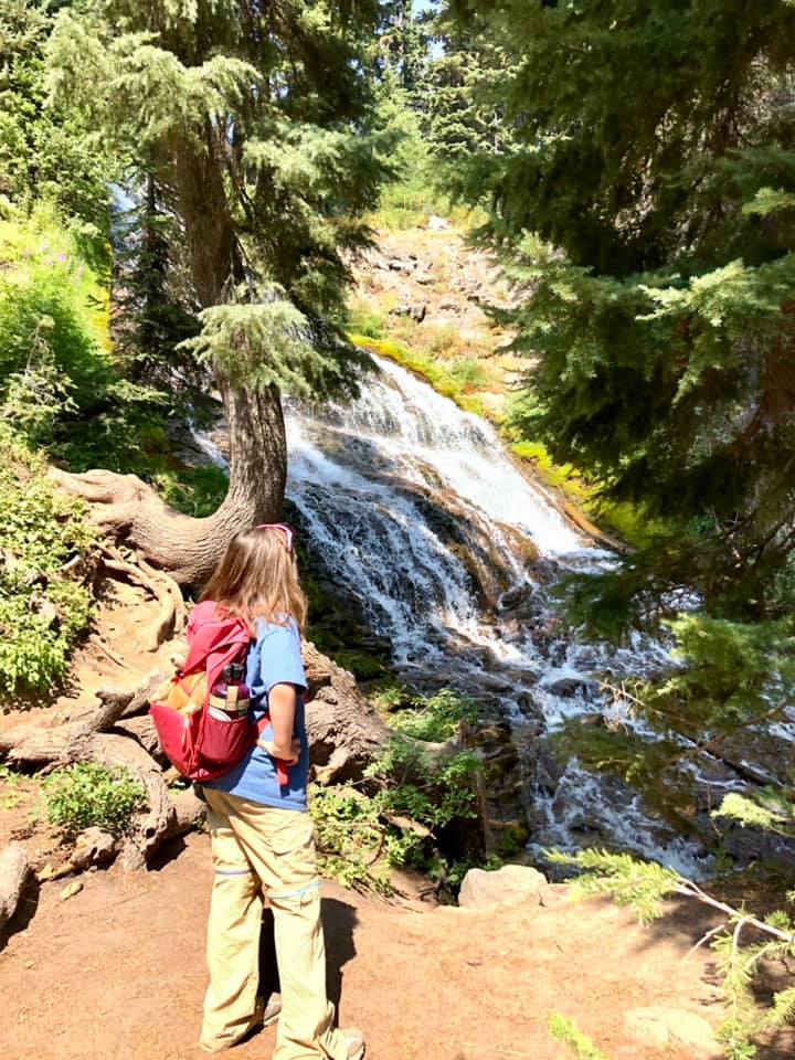
After your hike, you can add on a short trip to Umbrella Falls (Hike #33 in little feet hiking: Mt. Hood) by heading to the southeast corner of the parking lot. Find a trail marked for the waterfall and follow this trail for about 1,000 feet before coming to Umbrella Falls.
Checking out Umbrella Falls
Important Things to Know:
Seasons: These trails are only open in the summer; confirm seasons here
Conveniences: Restrooms and restaurant inside the lodge, which is open Thursday through Monday; confirm hours here
Toilets: Restrooms available inside lodge on open days; the closest vault toilet is available at the Bennett Pass Trailhead 2 miles away
Risks specific to the trail: Mosquitoes early in summer; high altitude; sun exposure; lots of pollinators like bees; work vehicles on the service roads; creek crossings
Recommended extra gear: Mosquito repellent early in early summer; extra water; sun protection
Trailhead GPS coordinates: 45.329750, -121.662738
Driving directions: From the Highway 26/Highway 35 interchange, drive east on Highway 35 for 6.1 miles. Take the exit toward Bennett Pass and Mt Hood Meadows, staying left as you exit. Continue onto Mt. Hood Meadows Drive for about 1.5 miles to the parking lot. The lodge’s parking area is not open to the public on Tuesdays and Wednesdays, so on the those days you will need to park on the side of the road just outside the gated entry to the parking lot.
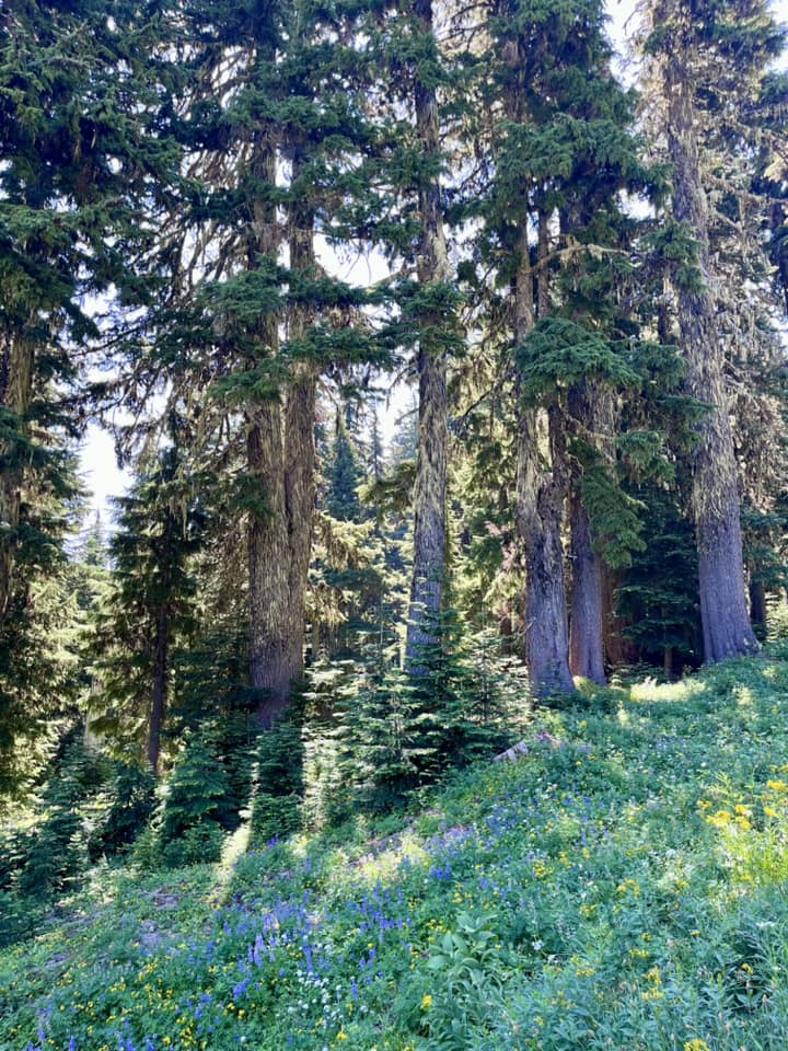
Pretty forest along the trailMt. Jefferson, as seen from the trailHike under these ski lifts