
Have you heard of Silver Star Mountain in Southwest Washington? It’s one of the most unique places in the area, and it is known for its epic wildflower bloom and breathtaking views.
The issue for families is that the main approach from Grouse Vista Trailhead requires a one mile slog straight uphill on an old, steep, rocky road before you even getting any views. The north Silver Star trailhead takes off quite a bit of that elevation gain (and gives you views from the get-go), but the access road is historically one of the worst roads around. My family has been hiking on this mountain for 17 years, and it has been a long time since I’ve seen the road in good shape…until today! In the past, only very high clearance vehicles could make it to the trailhead, but today we saw SUVs and Subarus that made it to the trailhead just fine. The group Friends of Road 4109 has been instrumental in getting this road back in shape, and road work on the access road just started a few days ago. I think the trailhead will be even easier to access when they are done with the road work on June 30th.
All this said, the road will always be on the rougher side due to its location, exposure, and the types of vehicles that drive on it, especially after heavy rain or snow. Please use your discretion to determine how safe the road is for your vehicle and family, and be prepared to turn around/back up if necessary. If you do need to pivot, consider hiking the nearby Larch Mountain hike described in my first book little feet hiking. Keep an eye on the Friends of Road 4109 page for updates on trail conditions.
NOTE: Because of the road repairs on Gifford Pinchot Roads 41 and 4109, access to the trailhead will be closed Mondays through Fridays 7am – 5pm through the end of June.


WHAT MAKES THIS PLACE SO SPECIAL?
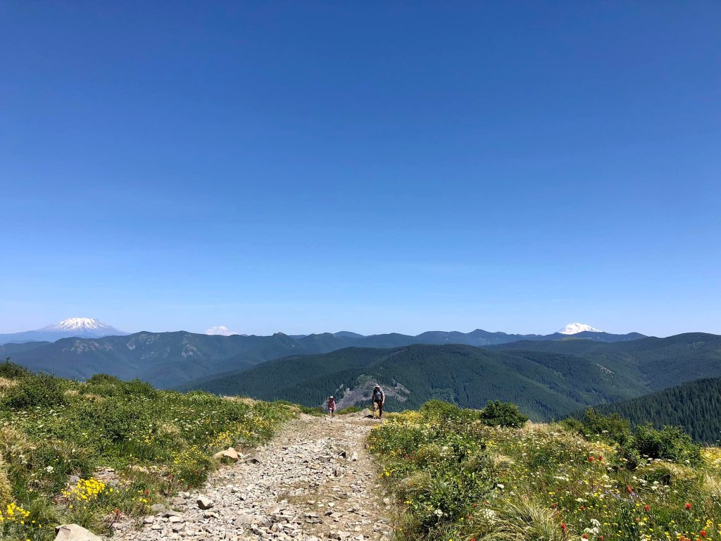
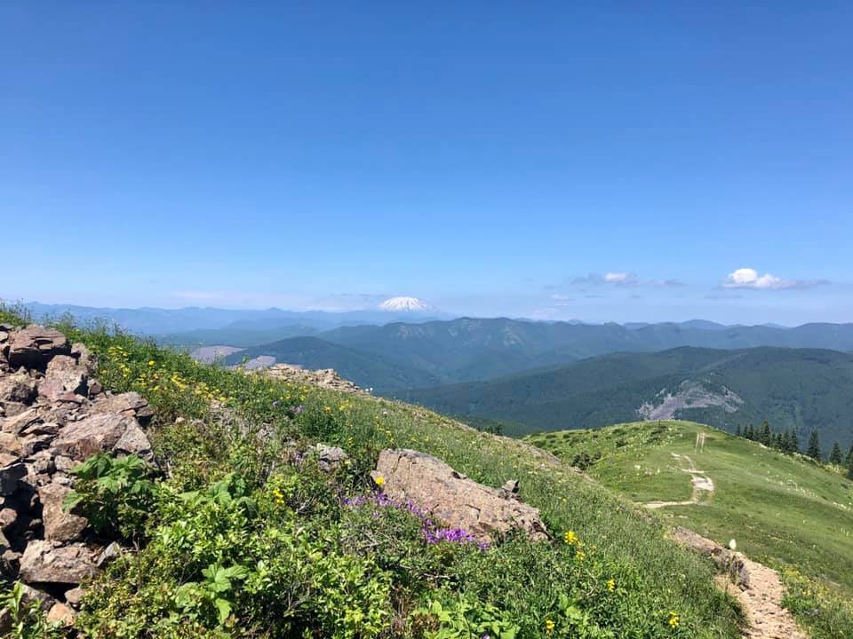
First off, the views are amazing – unlike anything you can find in the area. This mountain is made up of volcanic rock and can be seen from many spots in the Portland/Vancouver Metro area. You won’t actually see Silver Star’s summit on any of the recommended routes in this description, but you will be ON the mountain!
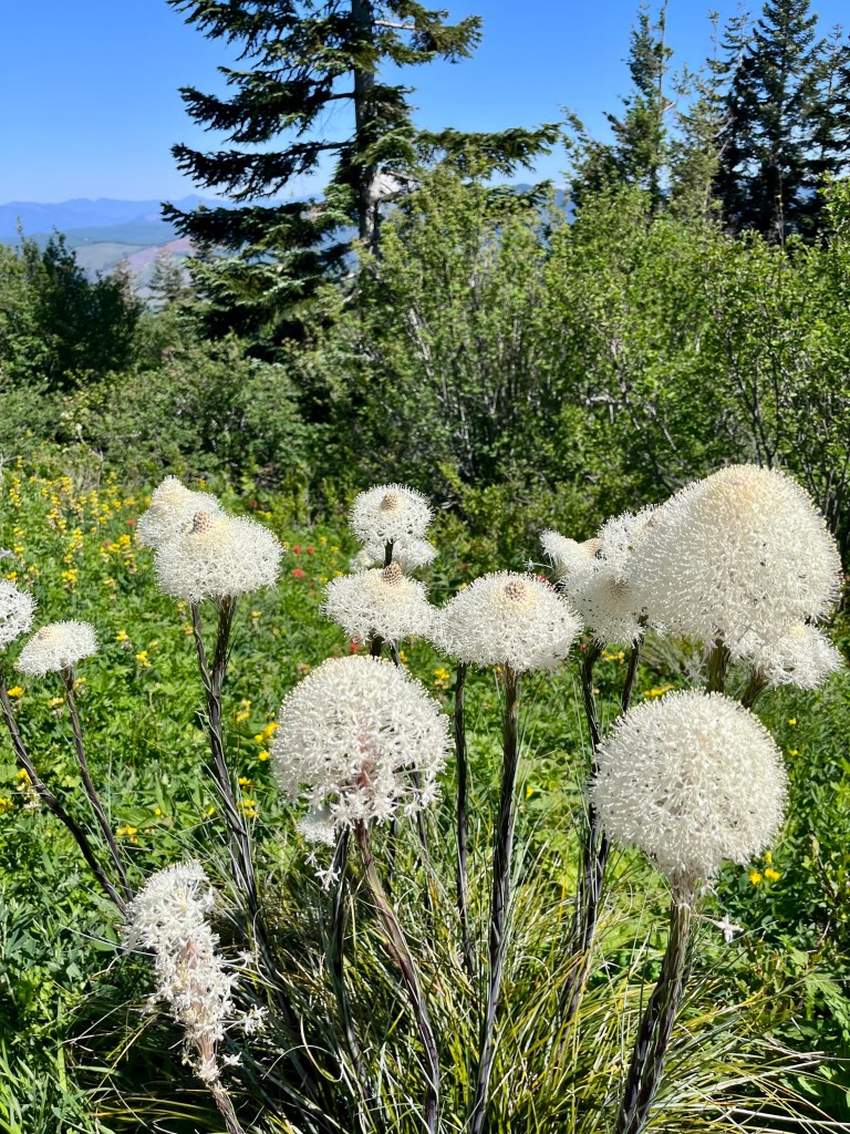
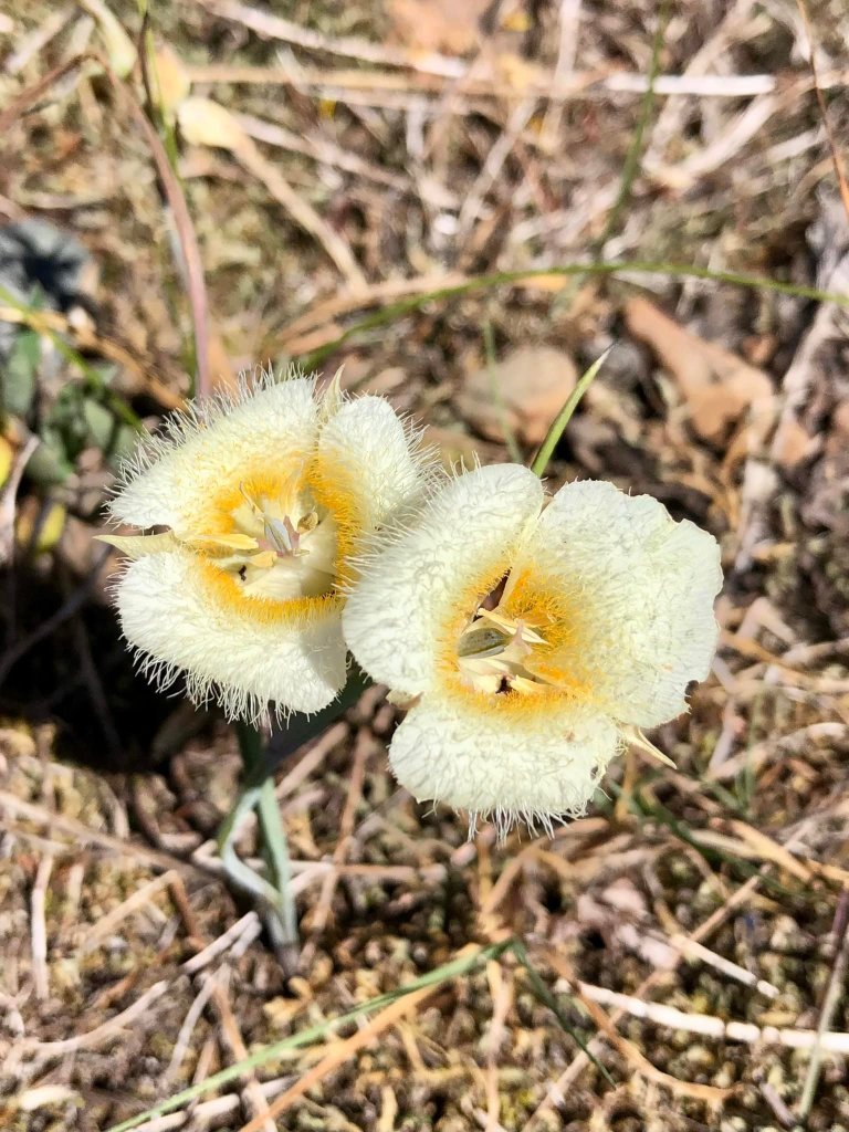
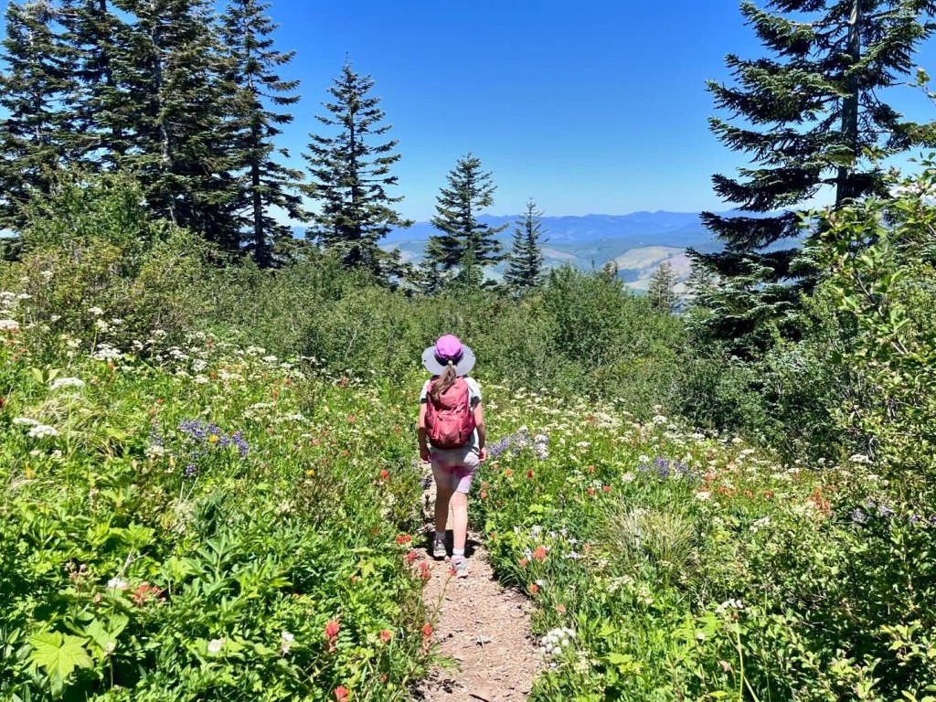
The mountain is known for its wildflower bloom, which lasts all summer long. You’ll also encounter a lot of pollinators like bees, birds, hummingbirds, and butterflies. Please do not let kids pick the flowers and teach them about Leave No Trace principles. The area is also amazing in the fall due to the changing fall colors. Snow starts flying sometime at the end of October or beginning of November.
Please note that there are currently no guide books or online hike descriptions that outline a Silver Star hike specifically for kids. Please use any other hike descriptions with extreme caution. I will outline some risks below, but please know that this area is remote and there are a lot of risks involved if safe decisions aren’t made. This hike description is only relevant until snow starts falling. After that, this area is inaccessible for quite some time.
THE HIKE: 1.2+ MILES ROUND-TRIP AND 500+ FEET OF GAIN WITH EXTENSION OPPORTUNITIES
From the trailhead, find a narrow trail next to a broken signboard. Follow this trail through a mix of sun and shade, and trees and flowers. There are steep drop-offs, but there is quite a bit of brush between the trail and the edge. The trail is a bit crumbly in spots, and extra caution should be exercised. After 0.3 mile, the trail connects up with the old road you saw at the trailhead. Sometimes people drive on this old road (even though they aren’t supposed to), so keep an eye and ear out. Hike uphill on the wide, rocky road for around 0.1 mile before coming to an epic ridgeline viewpoint of Mt. Hood and the valley below Silver Star Mountain. Don’t forget to look behind you to spy Mt. St. Helens, Mt. Rainier, and Mt. Adams! There are extreme drop-offs here, so you will want to stay far away from the edge.
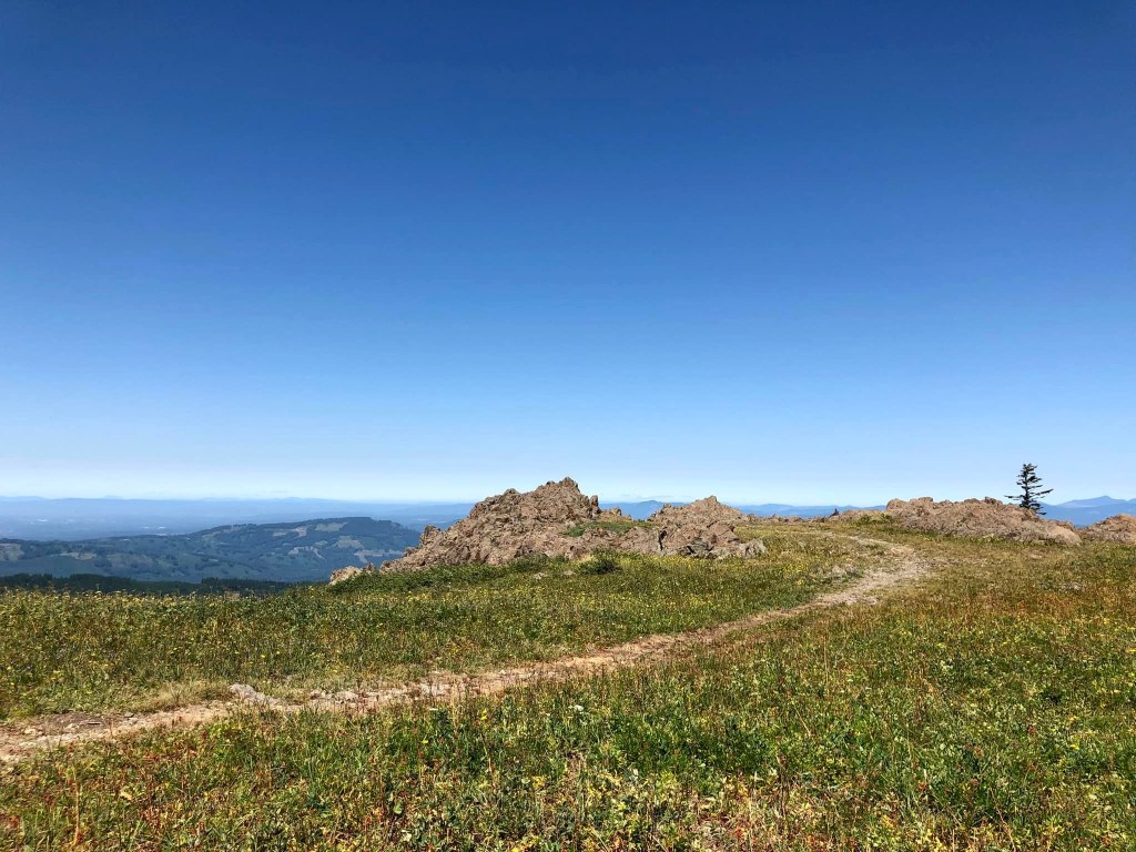
At this spot, you’ll see a trail going off to the left and a sign for Ed’s Trail. This trail runs along the cliff’s edge and is absolutely not kid-friendly. Stay right and continue to follow the old road up a small hill and around a corner. At about 0.6 mile into your hike, you’ll see an old jeep road going uphill to the left and some neat rocks on the right (there are cliffs on the other side of the rocks, so do not get too close). This is a great turnaround spot.


For a longer hike and some better views, you can head uphill on the old jeep road on the left. The trail comes to a saddle after about 0.2 mile. The trail continues past this, but the trail becomes narrower, rockier, and cliffier.

You could also continue straight on Trail #180. The trail steadily climbs before heading into the woods about 1.5 miles from the trailhead. From here, the trail stays in the woods and continues to climb until reaching the summit. You can learn more about that approach here. My daughter summitted when she was 9 years old, but I know kids a little younger do that too. You have to really educate yourself on the hike, come prepared with good sun protection and lots of water, and regularly check in with you and your kids’ abilities.

SOME THINGS/RISKS TO NOTE:
There is often garbage at the trailhead, so keep kids from walking through the old firepits or picking up broken glass, etc. There are also steep cliffs on one side of the parking area, and sometimes people drive on sections of the trail.
There isn’t much shade on this hike at all and you will be hiking at a higher elevation. The rocks can also reflect lots of heat back onto you. Bring more water than you think you’ll need and lots of sun protection. It is easy to twist an ankle or knee on the rocky and/or crumbly trail (especially on the downhill) and dogs will need to have really tough feet or booties. Hiking poles are recommended for stability. There are deadly drop-offs if you get too close to cliff edges on this trail. This isn’t a trail that you can let kids run around on. It is good to have an adult in front to make sure you can adequately prepare for the risks ahead. Kids hiking this trail will need to be able to follow direction for their own safety. Follow this hike description at your own risk. This is a helpful map to have before you set out.
DIRECTIONS:
Information on the Silver Star Trailhead can be found here. If you come from L1100 (which I would recommend until Forest Road 41 in the Gifford Pinchot National Forest is repaired), the road isn’t too bad until you get on Forest Road 4109. You’ll have 2.5 miles of rugged road as described earlier in this post. There are no passes required at the trailhead, which is just a big gravel pull-out.
LIABILITY:
The author assumes no liability for injuries sustained by or accidents happening to readers and their hiking companions who engage in the activities described in the write-up. Although the author has made every effort to ensure that the write-up’s information was correct at press time, the author does not assume and hereby disclaims any liability to any party for any disruption, loss, or damage caused by errors or omissions, whether such errors or omissions result from negligence, accident, or any other cause. Mileages and elevation gain are rounded and can change based on the tool used to measure. Hiking poses some inherent risk. The author advises readers to take full responsibility for their safety and that of their children and know everyone’s limits. The author is not an expert. Before practicing the skills described in this hike description, be sure that your equipment and gear are well maintained, and you do not take risks beyond your level of experience, aptitude, training, and comfort level. The author makes her best attempt at outlining risks such as toxic plants, cliffs, dangerous animals, and hazardous water, but there are likely risks on these trails that are not noted.
